
SHIFTING WEATHER SYSTEMS
Southern Africa at increased risk of being hit by powerful Category 5 cyclones
Climate experts warn that with the way the southern African region has been warming, a Category 5 tropical cyclone landing could not be ruled out – and that should this happen, the region is woefully unprepared to deal with it.
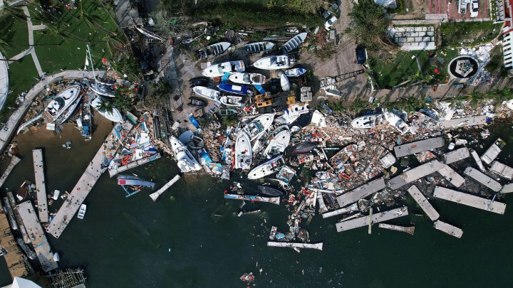
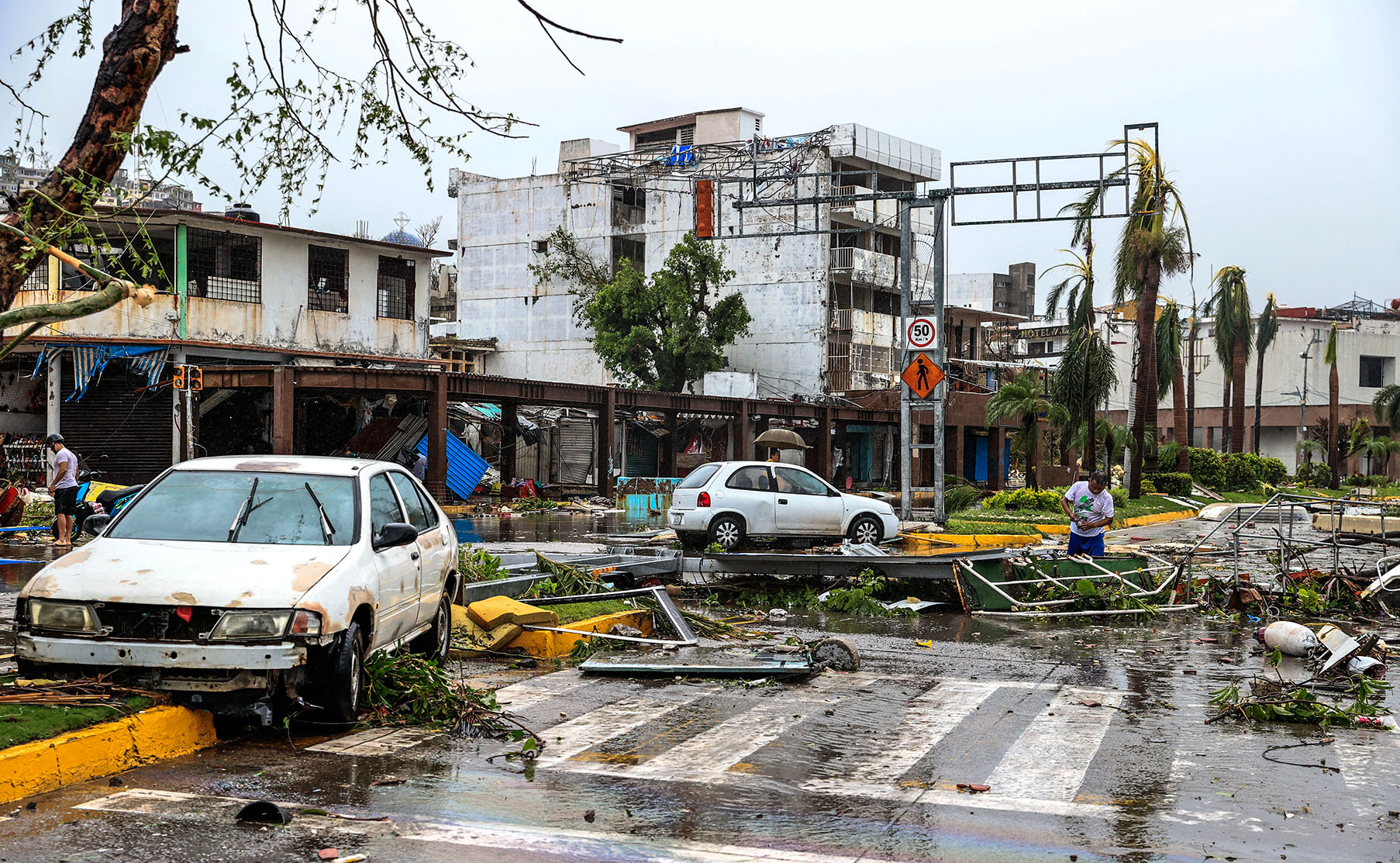
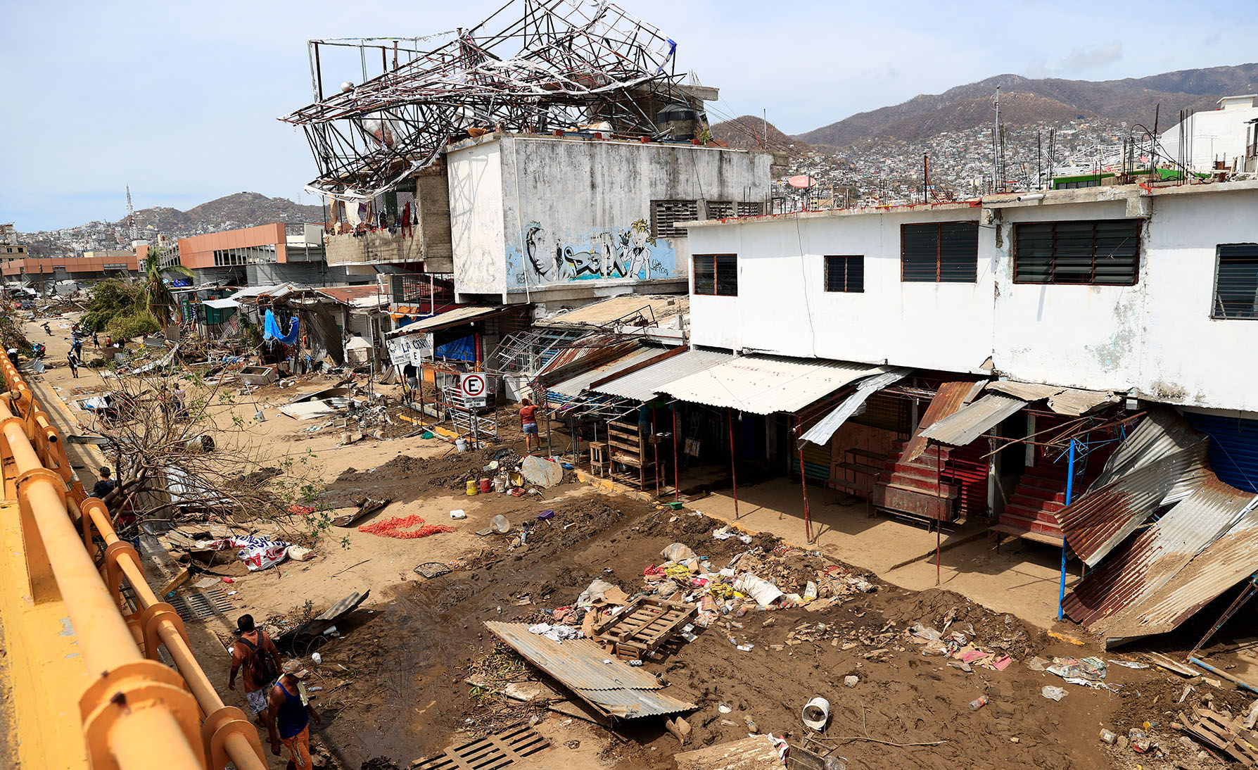
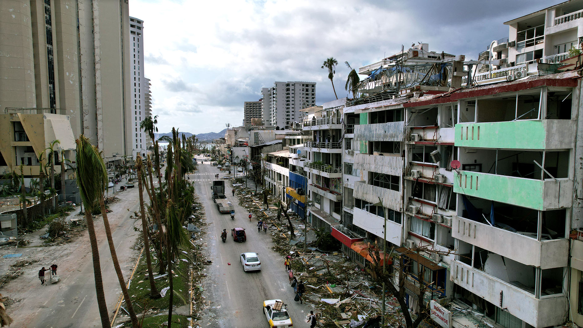
As devastation continues to spread across Mexico where Hurricane Otis made landfall over the coastal city of Acapulco on 25 October, with sustained wind speeds of 270km/h, climate experts warned that it may be just a matter of time before a similar event hits southern Africa.
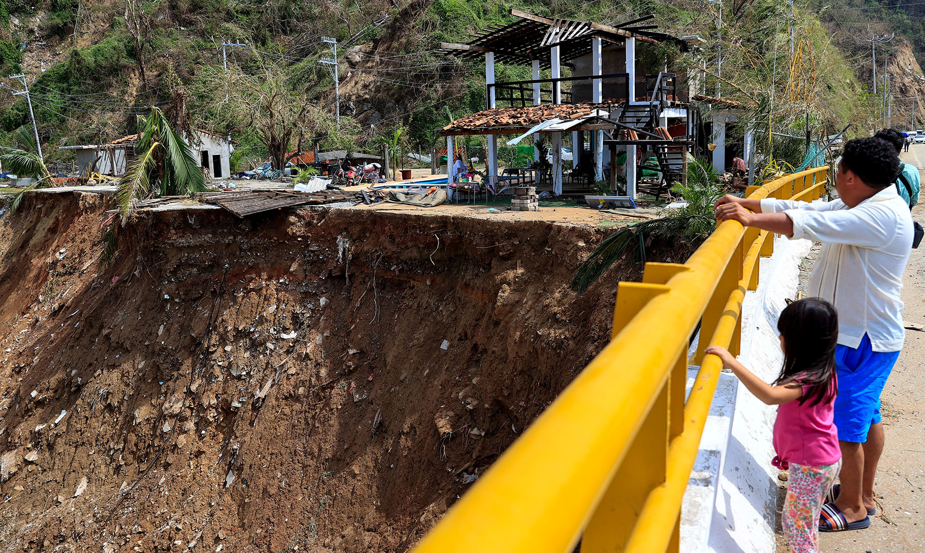
People look over an area affected by the passage of Hurricane Otis in Acapulco, Mexico. (Photo: EPA-EFE / David Guzman)
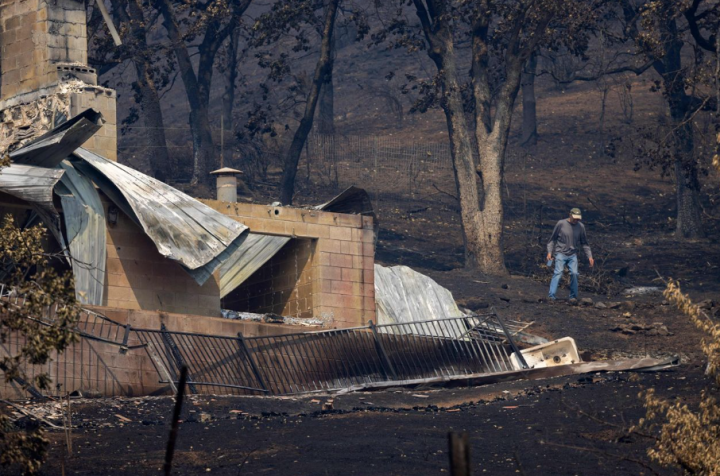
Debris and damaged vehicles after the passage of Hurricane Otis in Acapulco, Mexico. (Photo: EPA-EFE / David Guzman)
At the El Niño 2023 Summit hosted at the University of the Western Cape this week, researchers from the Extreme Climate Events Research Alliance confirmed that climate change was no longer regarded as a future threat.
New climate and weather records, as well as extreme events around the world, are becoming the norm.
Read more in Daily Maverick: Extreme weather on the way — and events like this are likely to become more frequent
Prof Erich Fischer – a lead author of the IPCC Sixth Assessment Report and lecturer at ETH Zürich – said that one only needed to look at Otis, the first Category 5 cyclone in recorded history to strike Mexico. This is the most intense type of cyclone, generating winds of at least 240km/h.
What was particularly significant, Fischer said, was that Otis went through a period of rapid intensification, moving from a tropical storm to a Category 5 hurricane within 24 hours, and that it made immediate landfall.
“From weather and climate perspectives, this is a very unusual event and it is unprecedented … a worst-case scenario,” he said.
Francois Engelbrecht – a professor of climatology and contributor to the IPCC reports – said this occurred because the ocean surface today is much warmer than it was 40 years ago, which means there is much more energy to fuel the storms.
Southern Africa faces risk
Speaking at the Summit on Wednesday, Engelbrecht said he was deeply concerned about a Category 5 cyclone hitting southern Africa because temperatures in the Mozambique Channel, and over the southwest Indian Ocean east of Madagascar, have risen substantially over the past few decades.
This was echoed by CSIR climate modelling senior researcher, Mohau Mateyisi, who explained that this meant the Mozambique Channel was becoming a more favourable environment for intense tropical cyclones to form, and similarly so to the east of Madagascar.
Engelbrecht added, “What we can already see is that the cyclones are becoming more devastating than in the past. They have become more intense… we have already published research showing that they cause more rainfall than in the past.
“Tropical cyclones Freddy (2023) and Idai (2019) caused more rainfall than they would have caused if it wasn’t for global warming. The risk now is that with this additional heat, it will not only be about more rainfall, it is also going to be about more intense storms…”
Cyclone Freddy left hundreds dead and half a million people displaced in Mozambique, Malawi and Madagascar. Engelbrecht said the worst storm seen in southern Africa was the Category 4 Idai, which affected Mozambique, Malawi and Zimbabwe and left about 1,500 people dead.
Read more in Daily Maverick: Life after climate displacement, and why we need to prepare communities
In an interview with Daily Maverick, Mateyisi said they would not be surprised should a Category 5 tropical cyclone hit, as the storm systems that approached South Africa through the Mozambique Channel were now moving southwards.
This means that if these systems were hitting Mozambique, north of the Limpopo Province, as they now moved southwest, they could shift and hit parts of the coast in eastern South Africa.
“We already see that the systems are shifting in a manner that can make this reality highly likely, even though we don’t know how likely it is in terms of probabilities.
An area affected by the passage of Hurricane Otis in Acapulco, Mexico. (Photo: EPA-EFE / David Guzman)
“However, for a more scientifically robust answer, one would need to look at the model and analyse the data in terms of seasonal forecast outputs, weather model outputs, and try to quantify in precise terms the probability of this happening,” he said.
Christien Engelbrecht, meteorologist at the South African Weather Service, said the likelihood of a Category 5 tropical cyclone hitting the southern African coastal belt within the next 10 years was certainly higher now than 30 years ago.
“I do not expect something of that magnitude in this coming season,” she said.
Preparedness for tropical cyclones
The other big risk, according to Francois Engelbrecht, was a Category 3 cyclone making landfall further to the south than ever before.
“We expect these Category 3 storms to occur in central Mozambique, but they’ve never in recorded history occurred as far south as Maputo or Richards Bay.
“What on earth would happen if a Category 3 to 5 cyclone were to hit Richards Bay? South Africans know nothing about how to prepare for these systems… and the risk of a Category 3 t0 5 going as far south as Maputo and Richards Bay does exist, but we don’t know how big the risk is,” he said.
Recalling Cyclone Domoina in January 1984, many South Africans believe they have experienced a severe weather event, but in reality, that was barely a Category 1 cyclone.
An aerial picture shows the destruction caused by Hurricane Otis in the hotel zone in Acapulco, Mexico. (Photo: EPA-EFE / David Guzman)
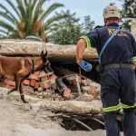
“From the Durban flooding, which is not nearly as devastating a system as a tropical cyclone, we have seen how unprepared South Africa is. We evacuated almost nobody… there was only the Quarry Road community that had a long-standing relationship with the University of KwaZulu-Natal and disaster management that evacuated, and we still lost more than 540 people,” he said.
Engelbrecht said South Africa had no established methodologies or approaches to evacuate 10,000 people two days before a tropical cyclone made landfall – this was when a warning would likely be sent out.
“We are completely unprepared in Richards Bay and even in Maputo for a cyclone of a Category 5 intensity.”
Engelbrecht said, “It is highly likely that we will experience our first Category 5 cyclone in the next 10 years somewhere in southern Africa – most likely in Madagascar or central to northern Mozambique.”
Read more in Daily Maverick: While thousands of Africans still suffer from Cyclone Freddy’s devastation, researchers aim to improve early warning systems
The risk of a Category 3 to 5 cyclone going as far south as Maputo and Richards Bay is currently being investigated by the Resilience and Preparedness to Tropical Cyclones across Southern Africa project, along with methods and strategies to improve early warning systems and boost resilience to tropical cyclones over the region. DM


Comments - Please login in order to comment.